Landscapes & Road Trips Motorcycling Road Trips:
2025 western plains landmarks trip recap#
Posted 2025-09-05
The loop of travel is shown in the following map. Intro and photos for Day 1 and Day 2 are below the map.
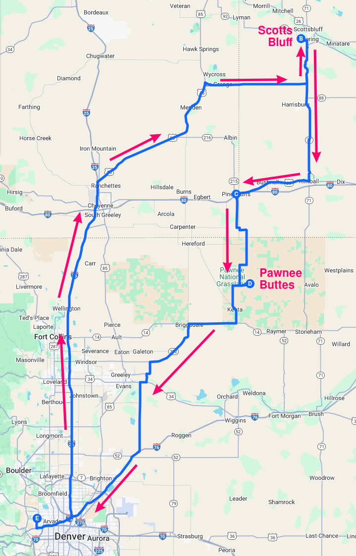
Map of the whole loop (426 miles)
Day 1 - Scotts Bluff National Monument#
This is one of the several parks across the U.S. where an early steward beheld the crowning rock promontory and exclaimed "let's build a road to the top of it." That Summit Road dream was realized stemming from a Civil Works Administration (CWA) project during the New Deal era. The road weaves through several tunnels and along the rock face to reach the summit. Summit Road is the kind of climbing, weaving road a motorcycle longs to travel -- the only letdown being that the trip is fairly short. I road the Blackbird to the top, stopped for a couple photos, and then road back down to the visitor center to get ready for hiking and a picnic.
Scotts Bluff NM's feature hiking trail is Saddle Rock Trail: a 1.6 mile one-way trail that starts from the visitor center and winds along and, in once case, through the rock formations, gaining 435 feet altitude and delivers you to a loop on the apex with several overlooks. There is an abundance of macro- and micro-level beauty here, and the hike provides some good exercise too. I took my time on this trail and thoroughly enjoyed its sights. I treated myself to a picnic at one of the many covered picnic tables when back to the visitor center.
Scotts Bluff NM seems to be a less frequented gem of the National Park Service. It nicely commemorates the Oregon Trail and the era of westward migration in which so many people followed the Platte River west in pursuit of new and better opportunities.
Several photos from the day follow. NOTE you might notice there was a haze on that day; I read that it was due to Pacific Northwest fires.
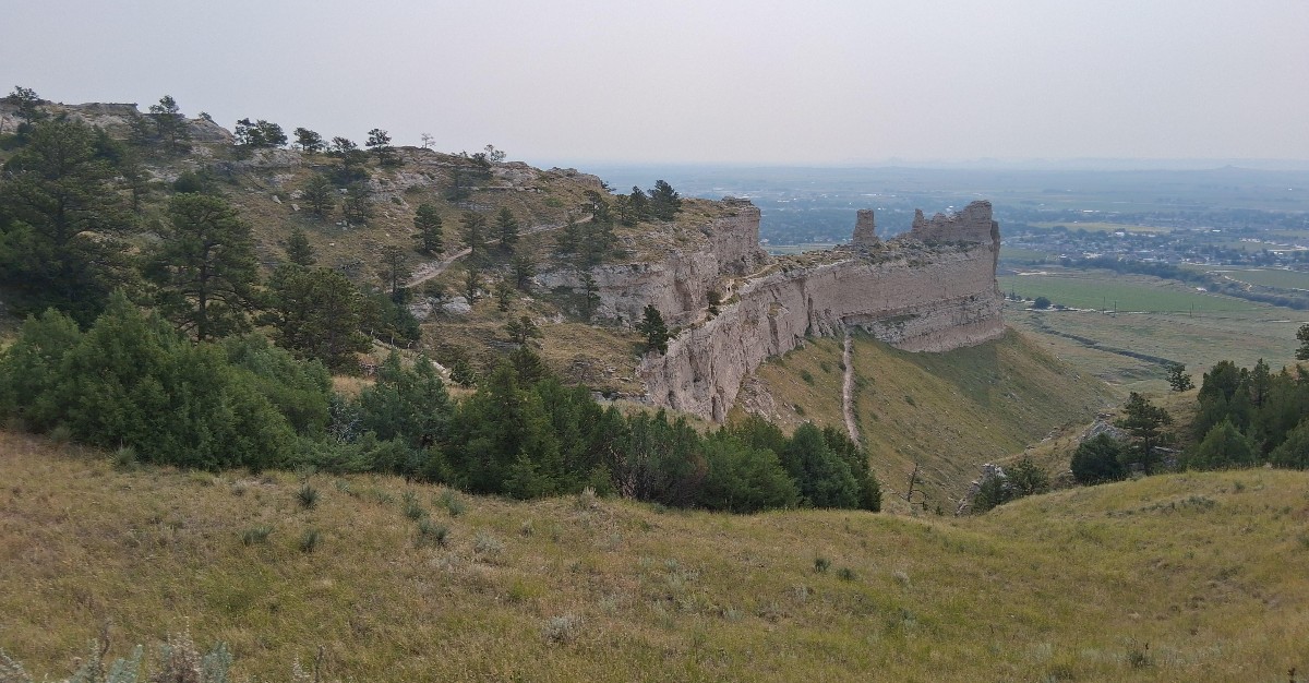
View to the east from the top of the Summit Road
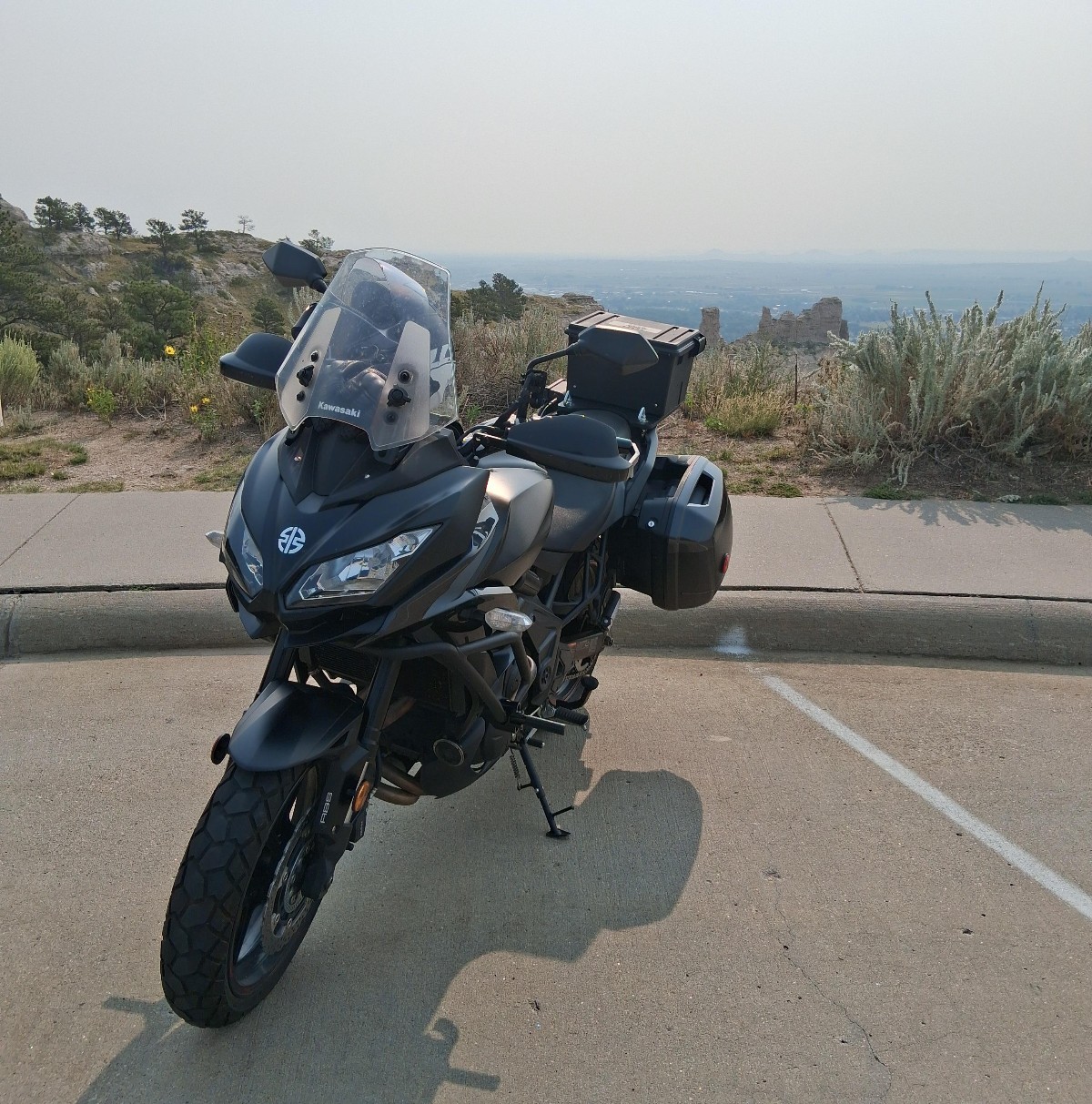
The blackbird at the Summit Road parking area
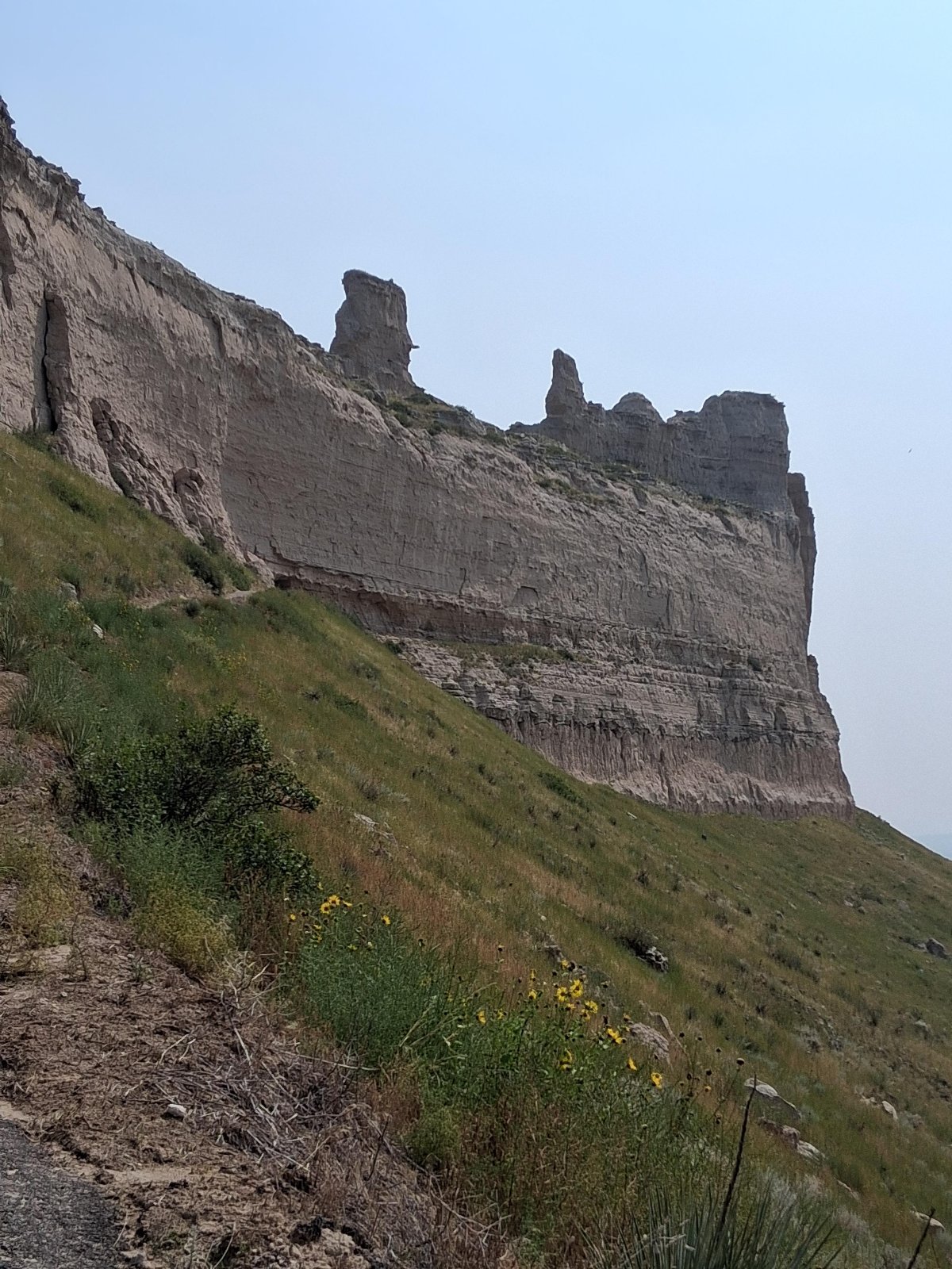
South side view of Saddle Rock from the Saddle Rock Trail

Another south side view of Saddle Rock from the Saddle Rock Trail, just prior to passing through the tunnel
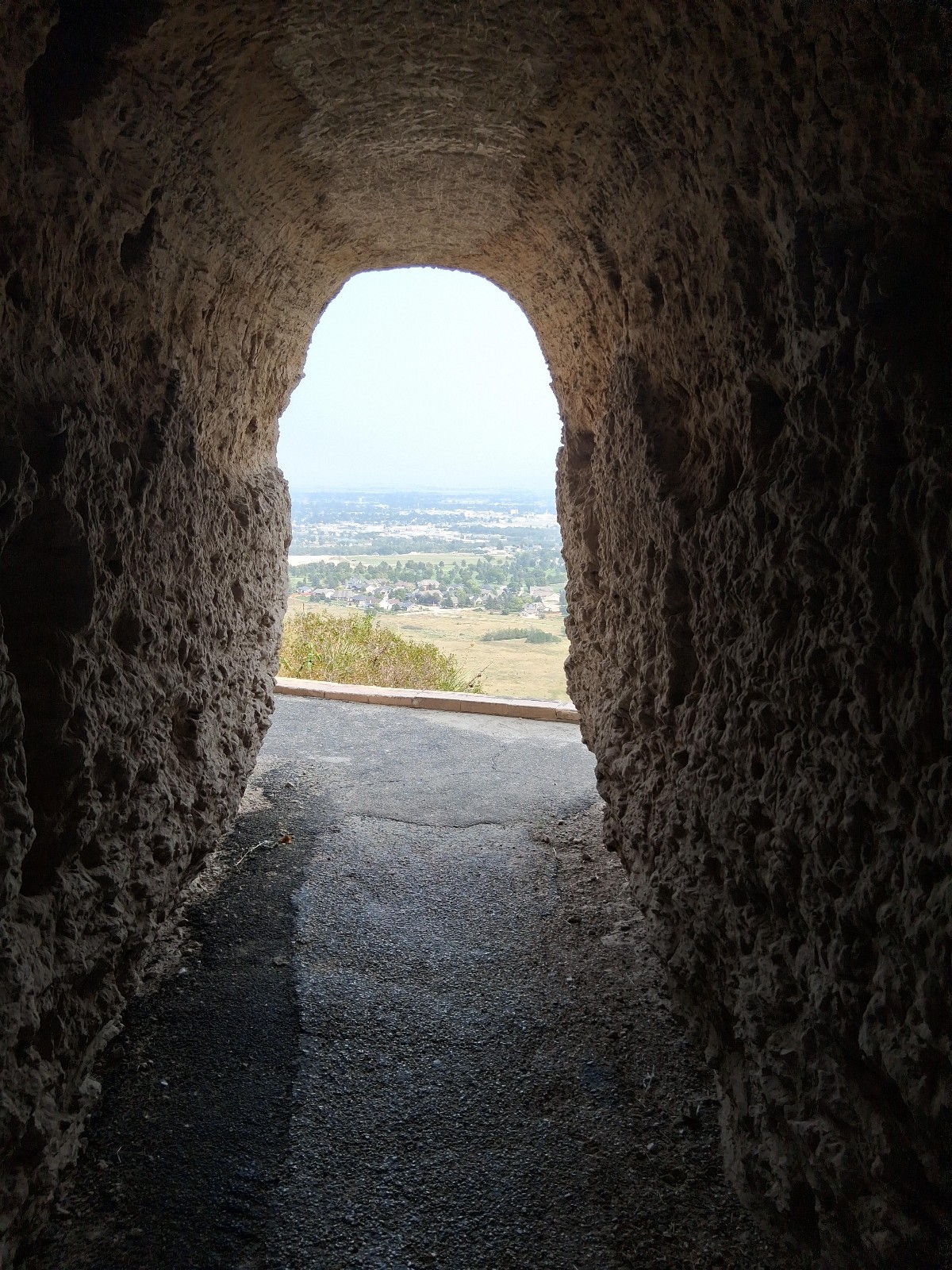
North view from within the Saddle Rock Trail tunnel
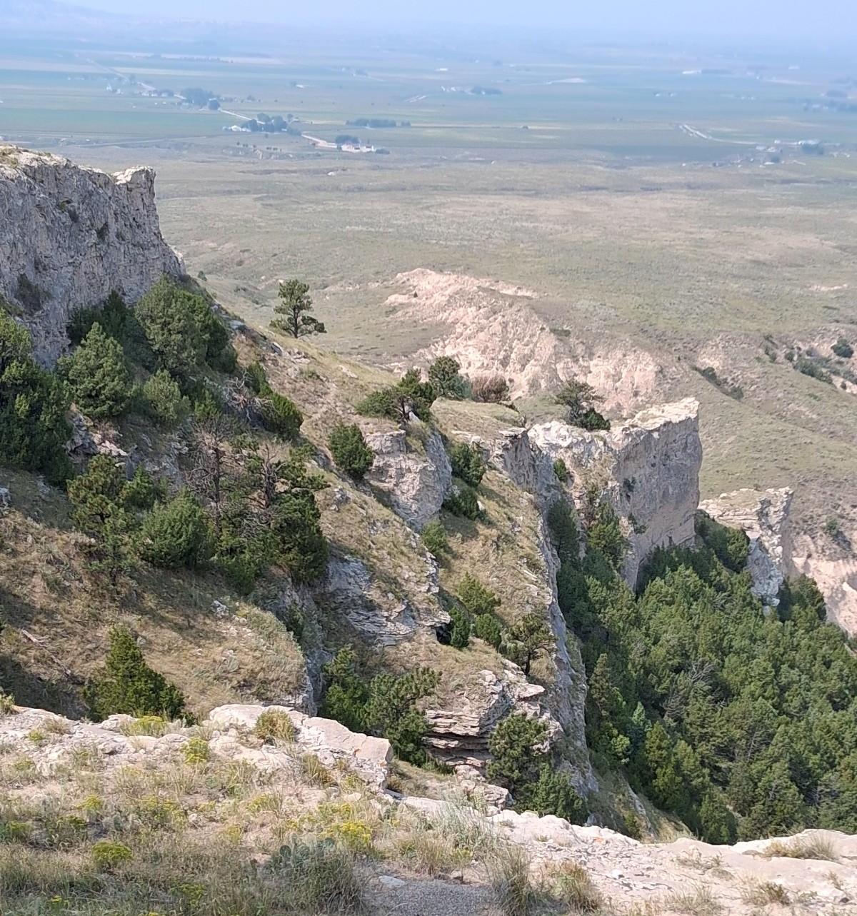
View back to the southeast as Saddle Rock Trail approaches the summit
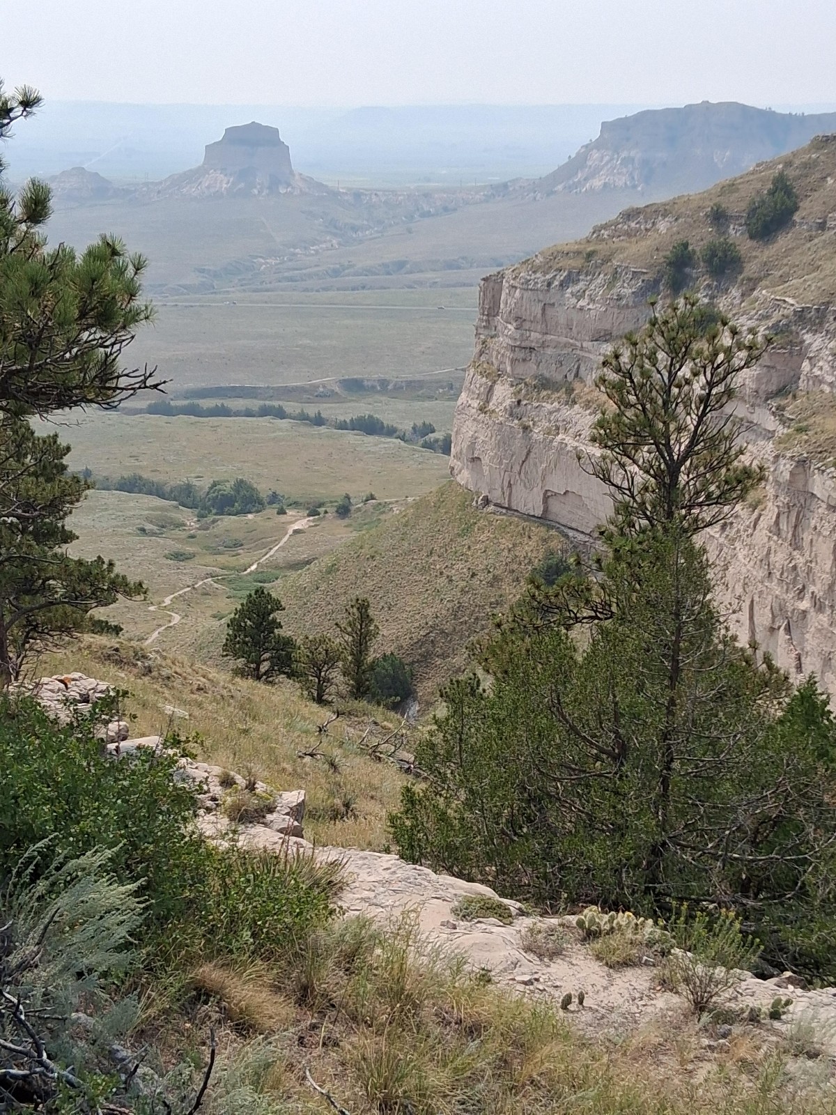
Looking down toward the northwest from North Overlook
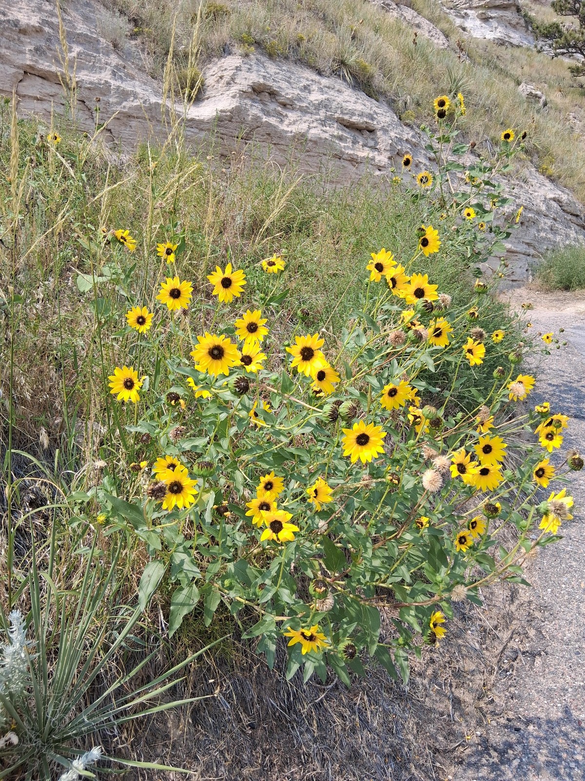
Some Common Sunflower (Helianthus annuus) near Saddle Rock Trail's apex put on a pretty show
Day 2 - Pawnee Buttes - Pawnee National Grassland#
Having stayed in Pine Bluffs, Wyoming for the evening (at which the Knotty Pine Saloon serves an exceptional cheeseburger and fries basket), the next morning I rode south into Colorado on gravel back roads to the Pawnee Buttes trailhead. The hike to the west butte is about 1.5 miles (one way) with only about 150 feet total elevation change. For part of the route one can take an alternate, shortcut passage over the top of a mesa; this route is closed from March 1 to June 30 each year to protect nesting raptors. I was pleased to take this alternate passage on the return and enjoy its different perspective. I had the trail to myself and the sights and quiet in that buffalo-grass expanse were inspiring.
A few photos from the hike follow. It was an overcast morning with a touch of the Pacific Northwest fires smoke detectable as well.
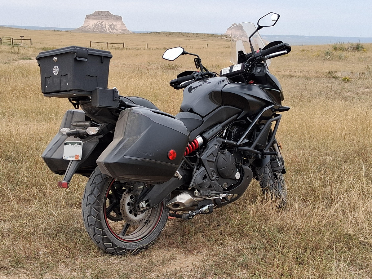
The Blackbird gets a reprieve at the trailhead
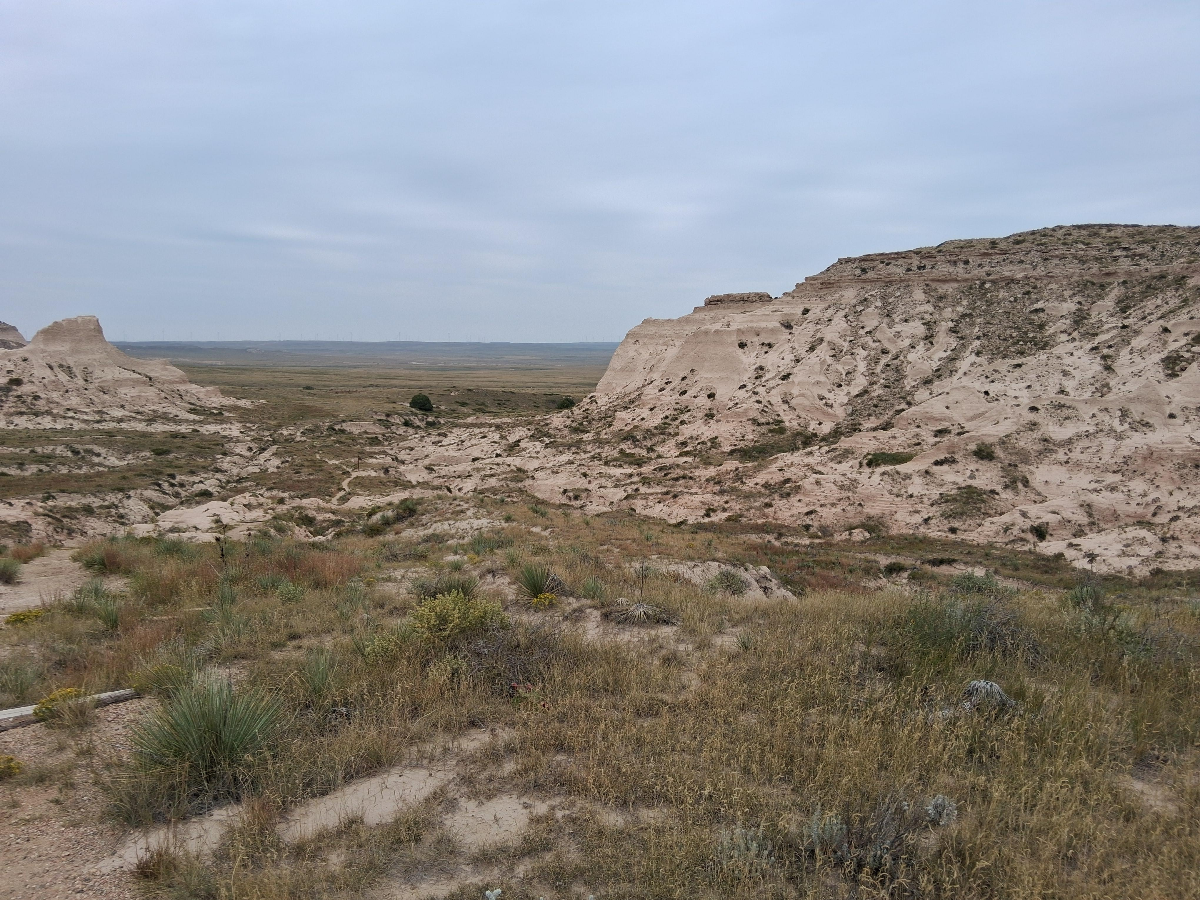
The trail's passage into a wash between two mesas.
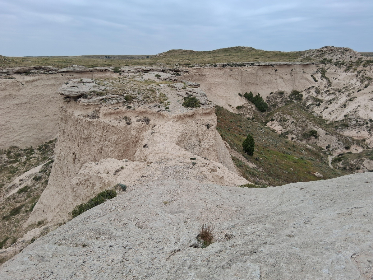
I took an alternate, high path on the return. It crosses this narrow rock bridge joining two mesas
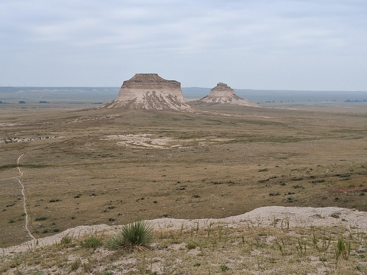
View of the Pawnee Buttes from atop a nearby mesa.
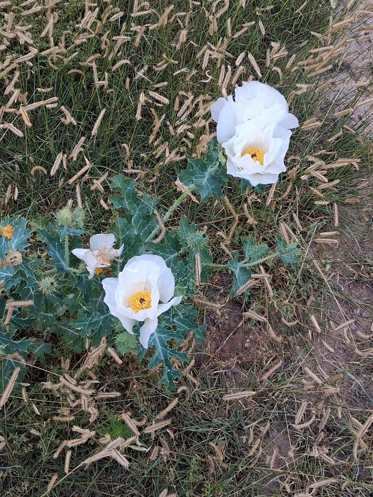
Crested Prickly-poppy were in bloom along the trail
Leave a comment
Submissions are subject to review and approval